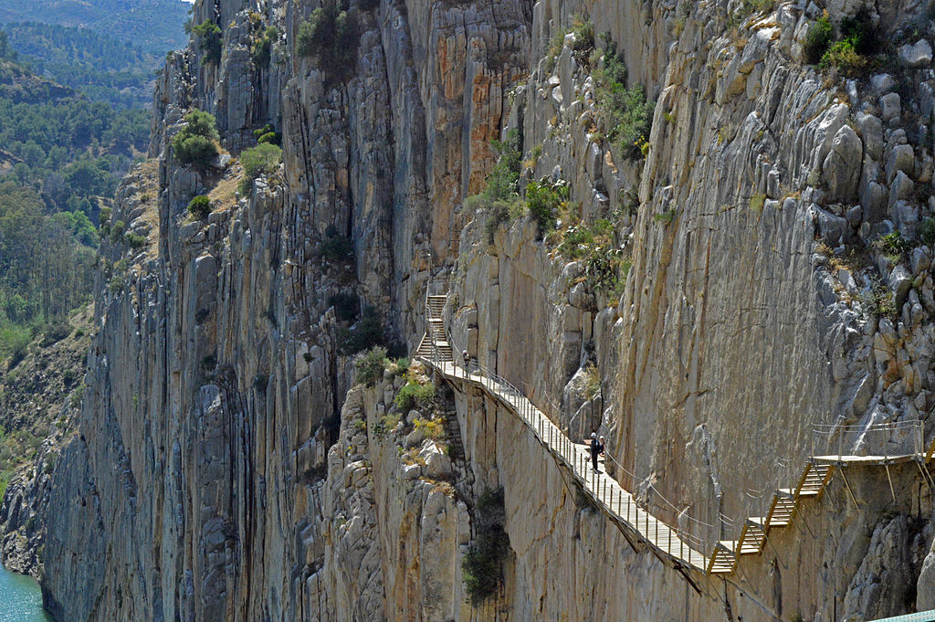
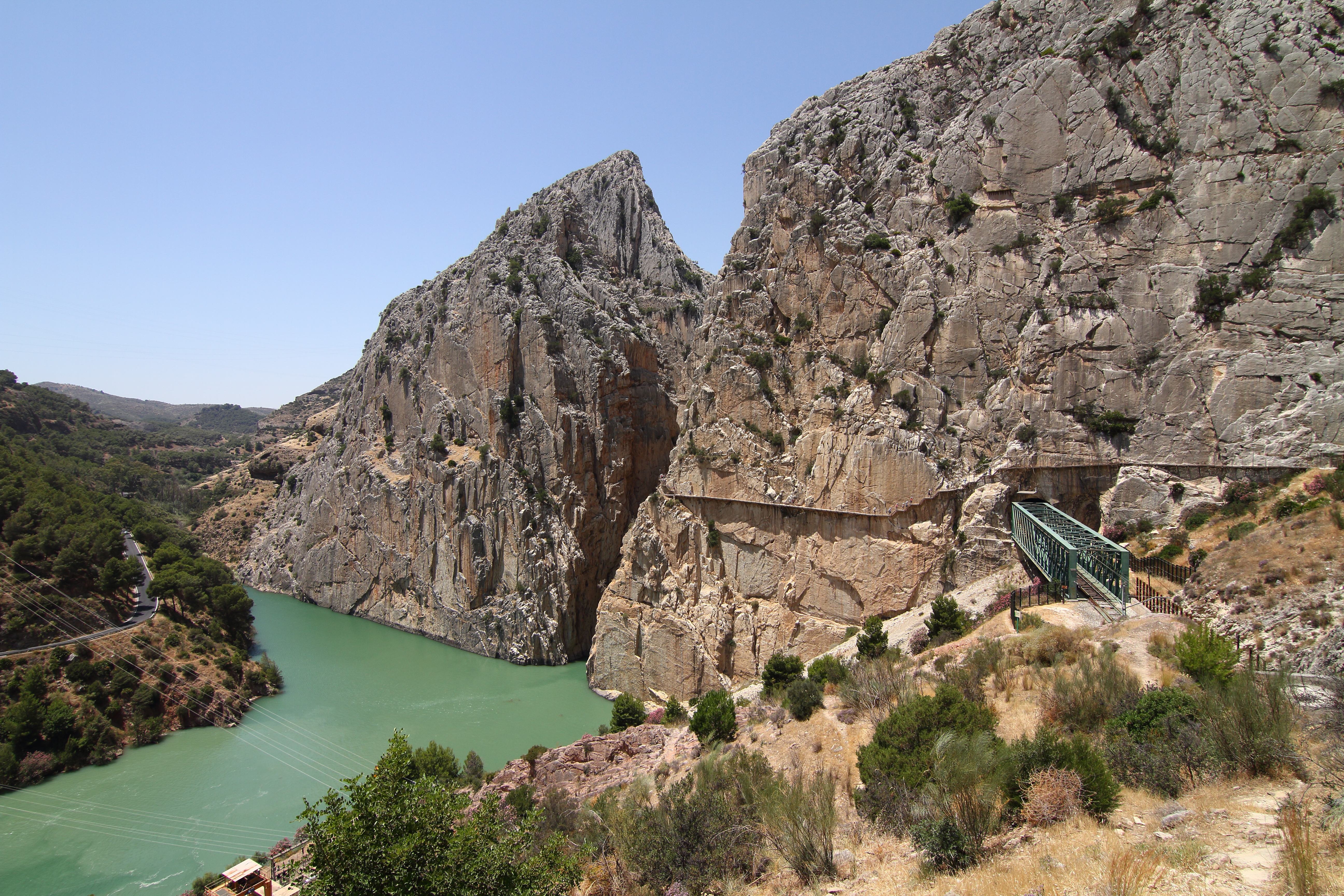
The Caminito del Rey, a pedestrian walkway hanging from the walls of the Gaitanes Gorge in Málaga
Actualizado el
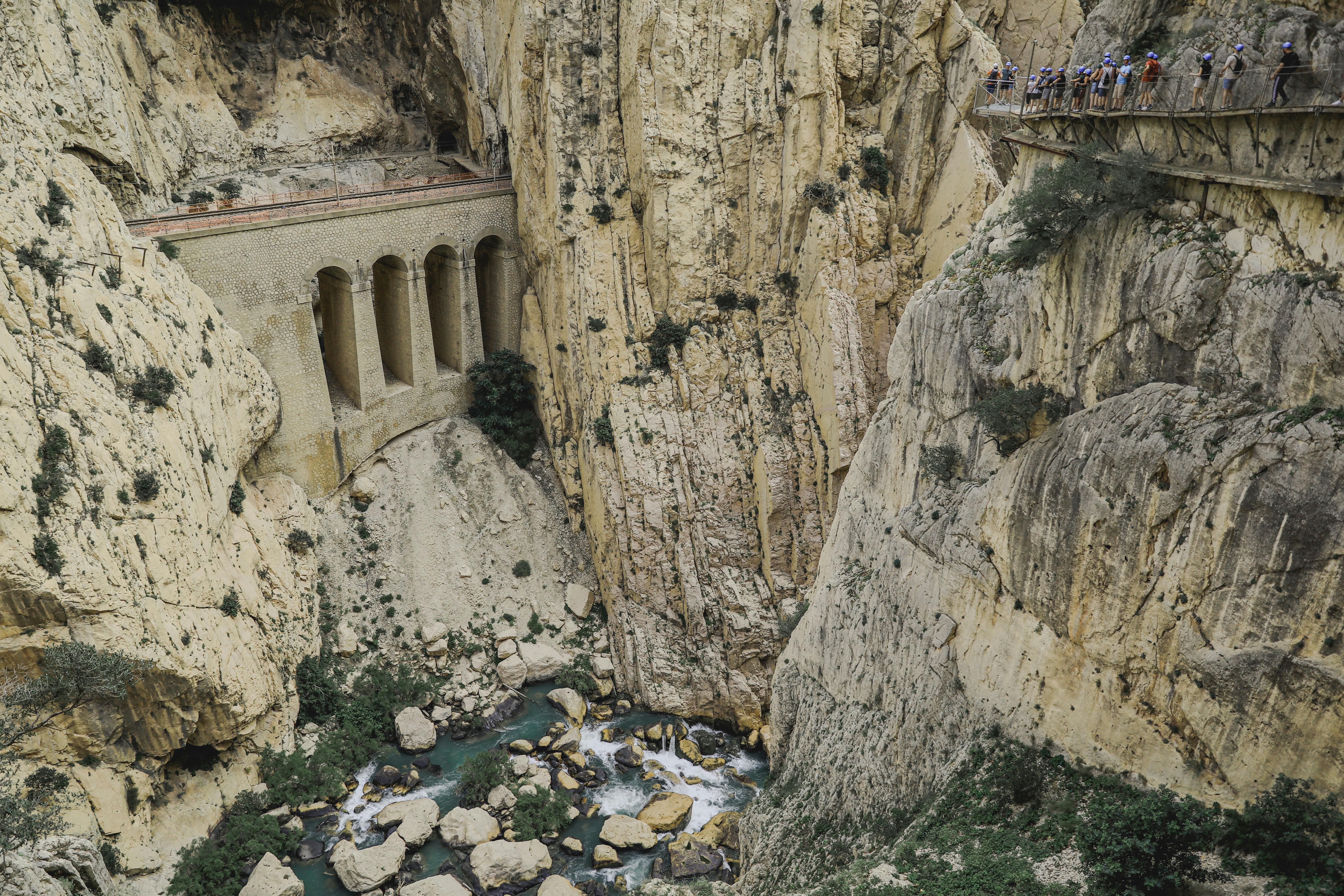
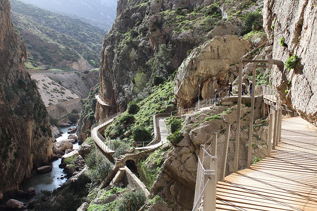
The Caminito del Rey is a pedestrian walkway suspended along the walls of the Gaitanes Gorge in the province of Málaga. Hanging more than a hundred meters above the Guadalhorce River, it crosses spectacular canyons and rock tunnels, turning the route into a unique scenic experience suitable for visitors after its complete restoration.
Where is the Caminito del Rey?
It is located between the municipalities of Ardales, Álora and Antequera, about 60 km from the city of Málaga. The northern entrance is at the Ardales Access (Guadalhorce reservoirs), and the southern exit at El Chorro (Álora), near the train station.
When and how was it built?
The original route was built between 1901 and 1905 to serve the hydroelectric works of the Gaitanejo and El Chorro power plants. In 1921, King Alfonso XIII walked along it to inaugurate the Conde de Guadalhorce reservoir, giving it the name “Caminito del Rey”. After decades of deterioration, it was restored and reopened to the public in 2015 with new, safe walkways attached to the rock.
Why is it so important?
- Exceptional landscape: limestone canyons, vertical walls and views of the Guadalhorce River from over 100 meters high.
- Engineering and heritage: historical walkways linked to the hydroelectric development of the region.
- Safe and accessible route: signposted trail with modern walkways, railings and controlled access.
What can we see during the visit?
- Gaitanes Gorge, the heart of the route, with almost vertical walls.
- Hanging walkways that allow walking attached to the rock above the riverbed.
- Suspension bridge at the final section, an impressive balcony over the canyon.
- Glass viewpoints for safely leaning over the void.
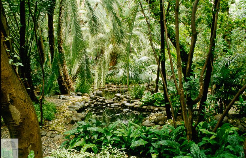
- Rock-dwelling flora and fauna: vultures, mountain goats and vegetation adapted to the cliffs.
How is the visit organized?
The route is linear (north to south) and covers about 7–8 km, including the approach trails. It takes 2.5–3.5 hours to complete, depending on pace and stops. Recommendations:
- Book online in advance (limited capacity; general or guided visit).
- Minimum age: usually 8 years. Wearing a helmet is mandatory (provided at the entrance).
- Footwear for hiking, water, sunscreen and wind-appropriate clothing.
- The trail may close due to wind or rain. Umbrellas and metal walking sticks are not allowed on the walkways.
- There is a shuttle bus (paid) between entrances to return to the starting point.
Where to find schedules and tickets?
Check the official Caminito del Rey website and the tourism portals of Málaga and the Costa del Sol for availability, prices, schedules and possible weather-related closures.
What else to see nearby?
- Guadalhorce-Guadalteba reservoirs, recreation areas and viewpoints.
- Bobastro, remains of the Mozarabic rock-hewn city and its cave church.
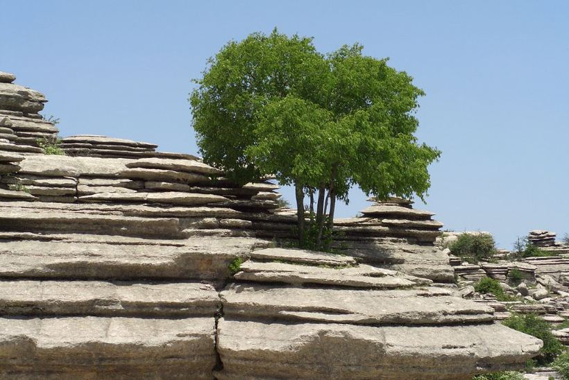
- El Torcal de Antequera, a unique karst landscape with marked trails.
- Álora, white village with a castle and views of the Guadalhorce Valley.
- Ardales, historic town with caves and mountain cuisine.
In summary, the Caminito del Rey offers an unforgettable walk through vertical canyons and spectacular walkways, combining industrial history, modern safety and the pure adrenaline and beauty of the Andalusian landscape.
How to get there
El Caminito del Rey comienza en el acceso norte, en el municipio de Ardales, cerca del restaurante El Kiosko. El recorrido es lineal y descendente, terminando en el acceso sur, en la estación de El Chorro (Álora). Tras aparcar en el Centro de Recepción de Visitantes o tomar el autobús lanzadera, para llegar a la entrada oficial, hay que pasar por un túnel peatonal y caminar por un sendero de 1,5 km o 2,7 km hasta la caseta de control de entrada en Ardales.
Decimal: 36.915833°, -4.772778°
DMS: 36°54'57" N, 4°46'22" O